

IMPROVING LIVES THROUGH DATA ECOSYSTEMS

Zamdela

82,339

25,067

5,7%

65,2%

82,2%

62,4%
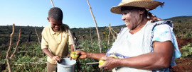
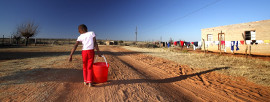
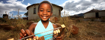
Zamdela is located next to the town of Sasolburg. The name is a Zulu word that means 'despise' or 'undermine'. (GPS coordinates: 26.8577 S, 27.8725 E).
Character(s) left.
Reference(s)
- Hallowes D and Munnik V. 2006. Poisoned Spaces: Manufacturing wealth, producing poverty. groundWork.
Statistics South Africa (Stats SA) monitors the quality of the information available on this website and updates the information regularly. However, neither Stats SA nor the Stats SA Website Department (StatsOnline) guarantees, or accepts legal liability whatsoever arising from or connected to, the accuracy, reliability, currency or completeness of any material contained on this website or on any linked site.
Key Statistics 2011
| Total population | 82,339 |
| Young (0-14) | 29,2% |
| Working Age (15-64) | 67,8% |
| Elderly (65+) | 3% |
| Dependency ratio | 47,6 |
| Sex ratio | 104,3 |
| Population density | 3851 persons/km2 |
| No schooling aged 20+ | 5,6% |
| Higher education aged 20+ | 5,7% |
| Matric aged 20+ | 28,5% |
| Number of households | 25,067 |
| Average household size | 3,2 |
| Female headed households | 35,5% |
| Formal dwellings | 78% |
| Housing owned/paying off | 57,2% |
| Flush toilet connected to sewerage | 62,4% |
| Weekly refuse removal | 71,8% |
| Piped water inside dwelling | 65,2% |
| Electricity for lighting | 82,2% |