

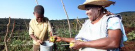
IMPROVING LIVES THROUGH DATA ECOSYSTEMS

Brakpan

73,080

21,656

17,4%

83%

90,8%

90,4%
Brakpan was originally founded in 1886 on the farm Weltevreden No 20 and officially proclaimed in 1912. The name itself refers to a pan of brackish water located nearby: brak is Afrikaans for 'brackish'. Extensive gold and coal mining have taken place in the area. It is claimed that in 1905 Brakpan was the home to the highest mine dump in the world at the time, measuring 120 metres in height. (GPS coordinates: 26.2938 S, 28.3359 E).
Character(s) left.
Reference(s)
- Raper PE. 2004. New dictionary of South African Place Names. Jonathan Ball Publishers.
- http://www.wikipedia.org
Statistics South Africa (Stats SA) monitors the quality of the information available on this website and updates the information regularly. However, neither Stats SA nor the Stats SA Website Department (StatsOnline) guarantees, or accepts legal liability whatsoever arising from or connected to, the accuracy, reliability, currency or completeness of any material contained on this website or on any linked site.
Key Statistics 2011
| Total population | 73,080 |
| Young (0-14) | 21,8% |
| Working Age (15-64) | 71,2% |
| Elderly (65+) | 7% |
| Dependency ratio | 40,4 |
| Sex ratio | 102,3 |
| Population density | 400 persons/km2 |
| No schooling aged 20+ | 1,9% |
| Higher education aged 20+ | 17,4% |
| Matric aged 20+ | 41,4% |
| Number of households | 21,656 |
| Average household size | 3,1 |
| Female headed households | 26,4% |
| Formal dwellings | 91,1% |
| Housing owned/paying off | 52,2% |
| Flush toilet connected to sewerage | 90,4% |
| Weekly refuse removal | 90,3% |
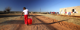
| Piped water inside dwelling | 83% |
| Electricity for lighting | 90,8% |